The Aislabie Walk

Mist over Hackfall

Valley near Mickley

The Fountain Hackfall

Rustic Temple Hackfall

The Banqueting House Hackfall

Beech Tree Hackfall

View to Masham Limehouse Hill Hackfall

Studley Royal Temple of Piety

Studley Deer Park

Pond near to Mickley

Braithwaite Hall

Azerley Tower

Weir at Studley Royal
The Route
During the mid 18th century William Aislabie owned estates at Studley Royal, Laver Banks and Hackfall. He and other members of the Aislabie Family created a picturesque landscape to delight their guests and transported them by carriage and on horseback through this sublime countryside on byways and tracks. There is some evidence that the Aislabies established a circuit that connected their estates and gardens and the Aislabie Walk roughly follows this circuit so that today's walkers can enjoy the same sublime landscapes on foot. The Woodland Trust working in partnership with the National Trust, Nidderdale AONB and North Yorkshire County Council to bring the route together and enlisted Mark Reid the author of The Inn Way to research and describe the route. The free booklet with historical and topographical notes is the result of this collaboration. The whole circuit or "long route" is 17.5 miles long and it is advised to allow eight to nine hours to complete it but you could take much longer if you take time to enjoy the vistas and places of interest. There are two cross paths that allow the walk to be divided into three shorter walks of between 7.5 miles and 8.5 miles each and of course there are options for an medium route of 11.5 miles if you take the further cross path. In the booklet the route is described starting at the Lakeside car park at Studley Royal. This car park is pay and display, £8, or free for National Trust members, at the time of writing. It is best to use this car park rather than the Fountains Abbey main car park as this is locked quite early in the day and the time pressure might spoil your walk, especially if your car is locked in and you have no way to et home.

Short Description of the Route
Mark Reid has written a much better and more detailed description of the route available for download in pdf format here: Aislabie Walk Guide. Please note this is a large 2M file.
From Studley Royal to Galphay
From the Lakeside car park you pass through Studley Deer Park and along the edge of the National Trust Fountains Abbey estate past the visitor centre. You then follow the River Skell through Skell Bank Wood and Spa Gill Wood eventually passing the ruins of Aldfield Spa with its sulphur springs before turning East and passing through the village of Aldfield. You will turn NNW out of the village and pass by Clip'd Thorn Farm and North House towards Winksley. Next passing through the woods alongside the River Laver towards Laver Banks. In Laver Banks there is an opportunity to shorten the route to just 7.5 miles by continuing through the woods to Galphay Mill. The main route continues past Skeaf House into the village of Galphay.
From Galphay to Hackfall via Kirkby Malzeard
From Galphay you take the bridleway past the lovely Braithwaite Hall and Lawnwith to the bridge over Kex Beck to the East of Kirkby Malzeard.
At Braithwaite Hall you can take Hubber Lane across to Azerley if you want to complete a shorter route.
On the main route from the bridge over Kex Beck you follow the road past the Wensleydale Creamery to the ancient market cross in the village of Kirkby Malzeard turning right just before the Queens Head which serves a lovely pint of Black Sheep or Theakstone's past the Church and down into a valley by an old water mill.
From Kirkby Malzeard to Hackfall
100 metres or so past the mill you take a footpath through a small wood. The footpath then runs parrallel with the road into the South end of Grewelthorpe. You pass by the village pond and green to the Crown Inn which if open is an opportunity to pay a visit to the toilets by the back door or pop in for a drink or something to eat. Taking the lane down past the Church at the bottom of the hill is a rickety stile that takes you onto a path through fields and into Hackfall.
The route through Hackfall takes the footpath down the valley of Grewelthorpe Beck to the North of the stream before taking the left fork up to the Banqueting House which for some unfathomable reason has been dubed "the Ruin" by the Landmark Trust. The Banqueting House is built on Mowbray Point with a lovely terrace in front which is open to visitors from 11am until 3pm. The views from here are magnificant. Having taken in the views you pass along the top of the gorge past "Lovers Leap" before dropping down to the Pond and recently restored fountain.
From the pond you pass by the Grotto, 40 Foot Fall and on to Fishers Hall before following a section of the Ripon Rowel through Mickley Barras.
From Hackfall to Azerley
You leave the Ripon Rowel in Mickley Barras and take a path away from the river Ure towards a small unclassified road. After a short section of road take the bridleway through Coal Bank Wood and past Frizer Hill. Half a mile of walking on another unclassified road brings you to the main Ripon to Kirkby Malzeard and Grewelthorpe Road. This is a particularly dangerous section as cars coming from the Ripon direction often come around the bend at speed but cannot see you on the road until the last second. Vehicles comming in the other direction are able to see you for a longer distance. There is no footpath on either side of the road and the verge is more of a bank. Please be very careful!
Once you have negotiated this dangerous section of road you are back onto a narrow unclassified road into the hamlet of Azerley. If you are taking the short route from the North this is where you take Hubber Lane to Braithwaite Hall.
From Azerley to Galphay Mill
From Azerley Home farm you take the track past Eight Acre Wood to the ford and foot bridge before "Witch-of-the Woods House". The bridleway now takes you past Cow Myers Farm and on the Galphay Lane. This is where the cross path comes out if you are taking the short clockwise route. On the main route take the unclssified road down to the bridge over the River Laver and up the hill at the other side through the wood.
From Galphay Mill to Studley Royal
At the top of the hill a bridleway takes you South towards Low Lindrick Farm and through the Deer Park back to the lake at Studley Royal.
Short Route 7.5 miles allow 3 hours
Medium Route 11.5 miles allow 6 hours
Long Route 17.5 miles allow 8 to 9 hours
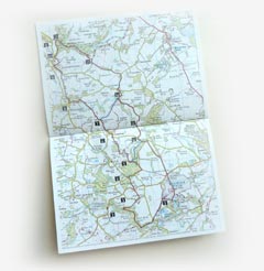
Map OS Explorer Sheet 298 'Nidderdale'
Download
A map of the route together with a detailed description written by Mark Reid is available to download in .pdf format.
This website is part of the Caravanwise community support program. Caravanwise is a caravan insurance specialist.